← tillbaka
Kurs
Hållbar stadsutveckling. Grupprojekt, programtermin 8.
Uppgift
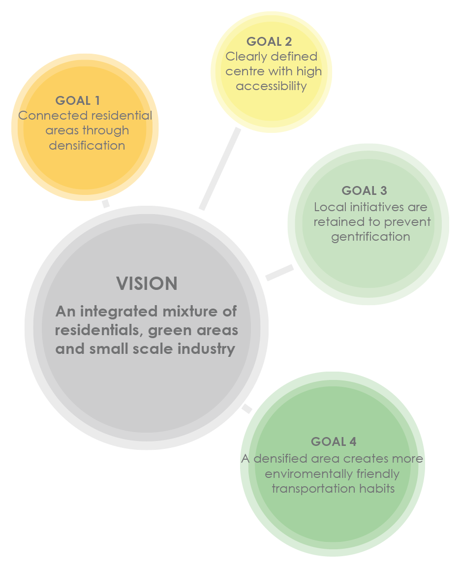
Ta fram strategier och visioner för existerande och framtida konflikter mellan markanvändning för bostadsområden och industri.
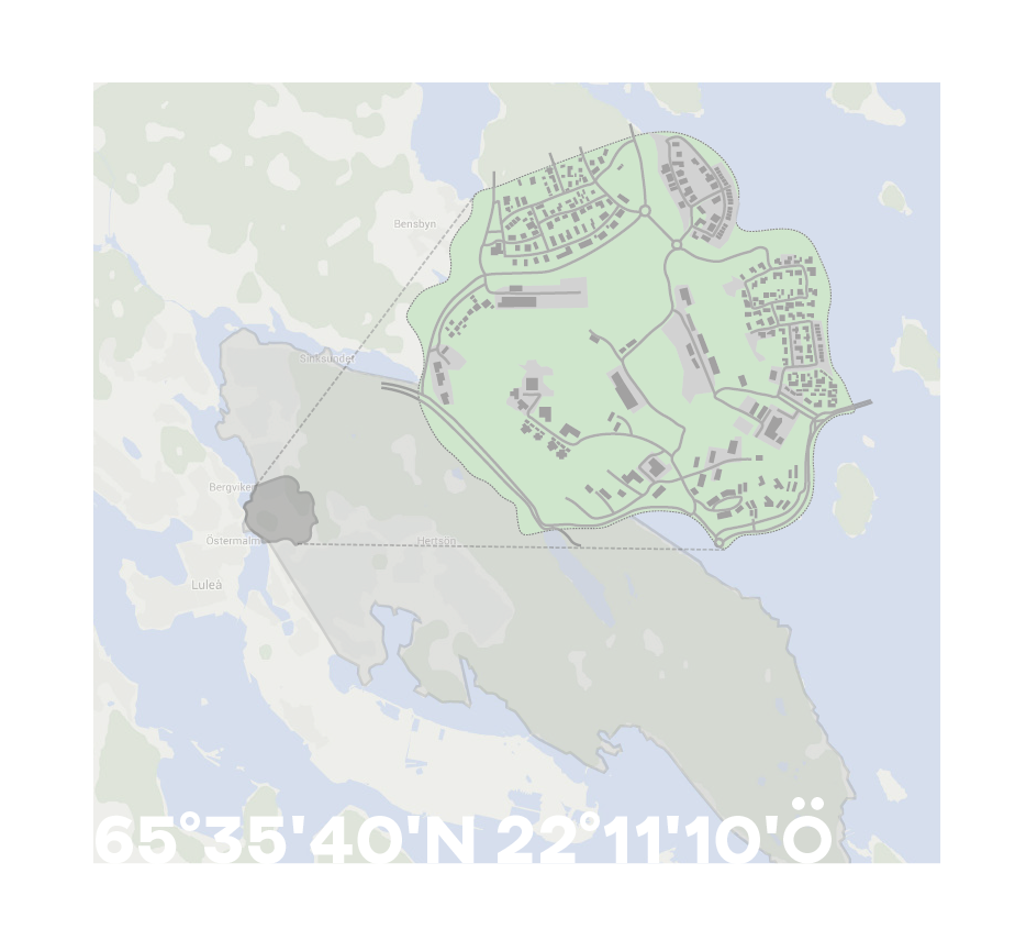 Within the assigned area (light grey in image above), the district Kronan (dark grey) is the area most exposed to land use conflicts involving residentials and industry.
Kronan is an old military area. The area was taken over by the municipality in 1993 when military activity moved to Boden.
A comprehensive plan for the area was adopted in 2004 with the aim of developing new housing areas, businesses and services. Kronan has historically been mostly woodlands and has only recently been the subject of city expansion and construction. As a result, residential areas and industrial areas are scattered throughout the area with a lot of green areas in between. Kronan is now subject to more city expansion than ever before, with several residential areas being built in a short amount of time.
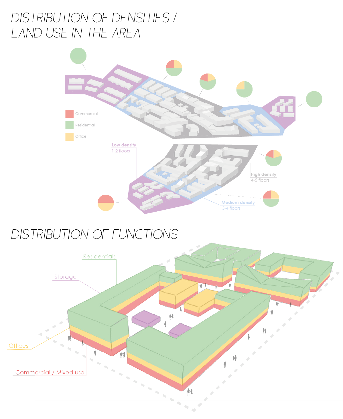
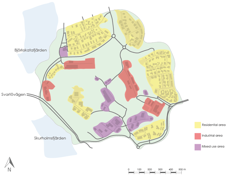 Land use
Land use by residential areas and industrial areas can be in conflict with each other by “sharing” the same area and having conflicting interests. The size and extend of industries and infrastructure and residential development also change the scope of the land use conflict.
 Heights
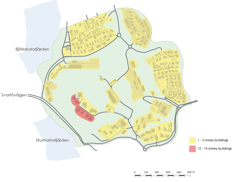
The image above describes the height of the buildings in the subareas of Kronan. The yellow fields indicates buildings with 1 to 3 stories, and the red (Lulsundsberget) buildings with 12 to 14 stories.
 Density
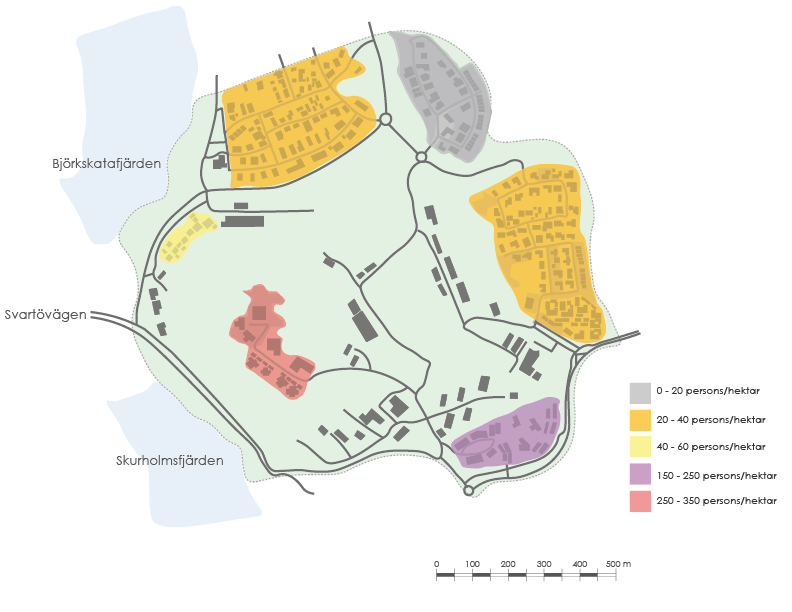
The map illustrates the population density in the different areas, based on a housing average. Colored areas represent density averages from roughly 20 people per hectare up to 350 people per hectare, with the highest population density in the Lulsundsberget area.
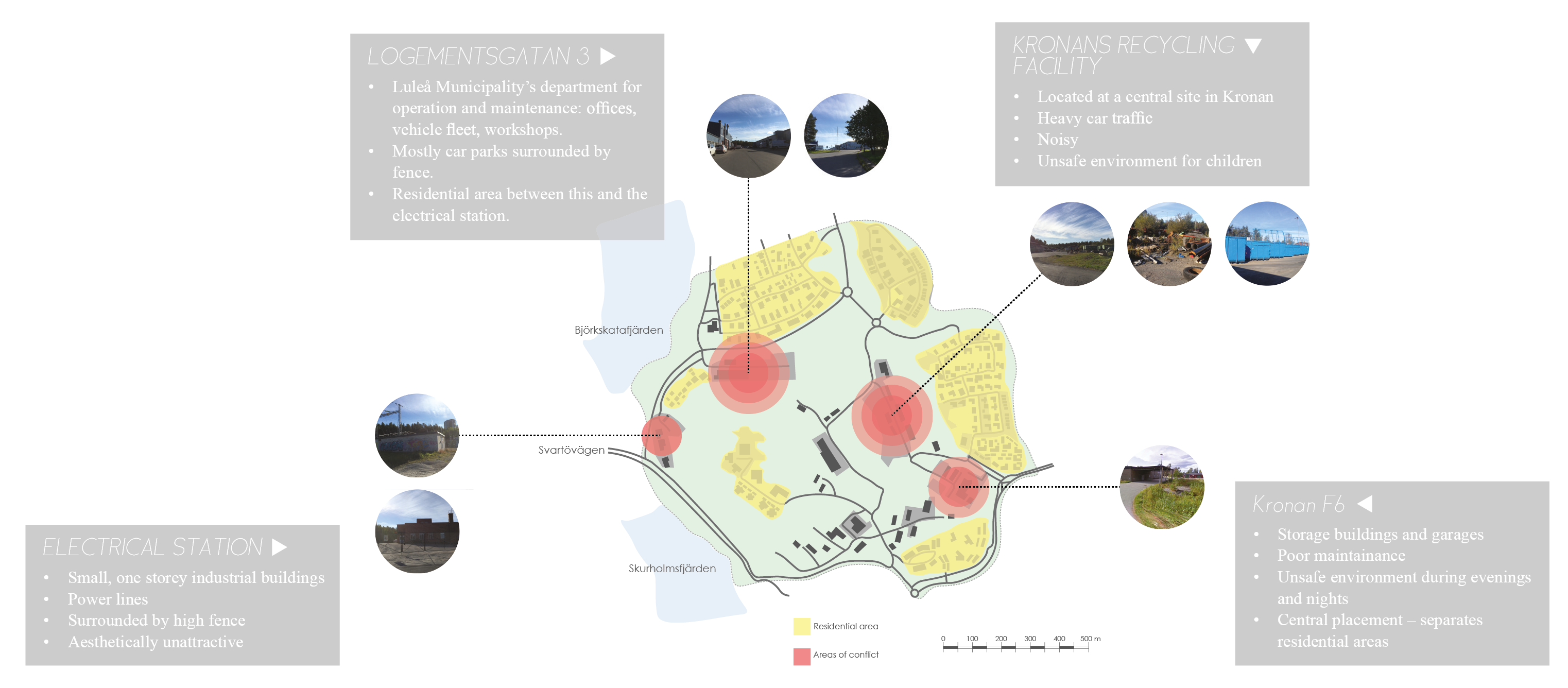 Areas of conflict
 Score
Score
4–6: The area is well developed and it does not require actions in the immediate future.
7–9: The area needs actions to mitigate existing and potential land use conflicts.
10–12: The area is in urgent need of an overall strategy and interventions to mitigate land use conflicts.
Conclusions from assessment
Since the industry is rather small scale, but with big sprawl, the extent of land use conflict has been evaluated as medium. Today Kronan is relatively isolated when it comes to public transportation, and the majority of transportation is conducted by car, hence the medium score in the infrastructural gap section. Buildings, infrastructure and industry are rather old, and the maintenance of these parts is a big contrast to the brand new buildings. Compared to Luleå as a whole Kronan has a low population density. Most of the residential areas contain of villas and thereby covering large area but with few residents. The area also has a high percentage of green areas in shape of forests. The evaluation of above mentioned aspects gave Kronan a score of 7, which as seen in table 2 is a medium score; “the area needs actions to mitigate existing and potential land use conflicts”.
 Movement patterns
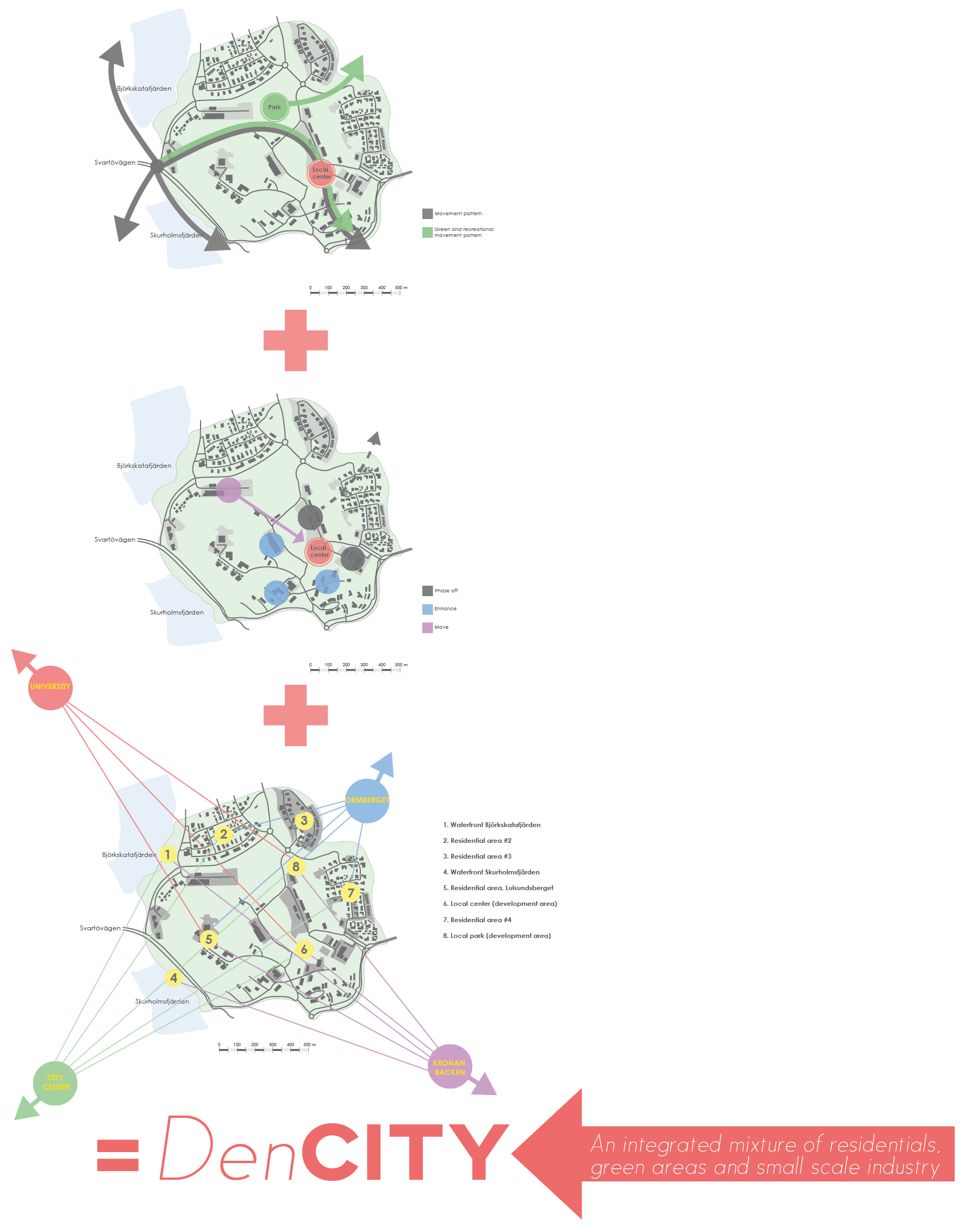
In the area the movement patterns are built up by four different flows and two green flows. The most essential is the one that flows through the area and connects with the local centre. The green and recreational movement patterns are also connecting the area with Ormberget which is an important resource nearby the area. The other movement patterns attach the area to the waterfront and also to Luleå city centre.
Redevelopment
The mapped out subareas are here representing different changes for the area. Some subareas will be phased out from the area and others that are considered important for the area will be enhanced. One subarea will be moved to the local centre. These changes of the subareas will contribute to achieve the vision for the project.
Connectivity surrounding areas
The subareas of Kronan will be connected to important parts of the surrounding areas. Important connections are here mapped out and will be a foundation for the more detailed plan in the final proposal. The important surrounding areas are the University, Ormberget (the local green/recreational area), the city center and the nearby residential area Kronanbacken. The key areas (within the defined area) are both areas that is important today but also the areas that are in focus for redevelopment.
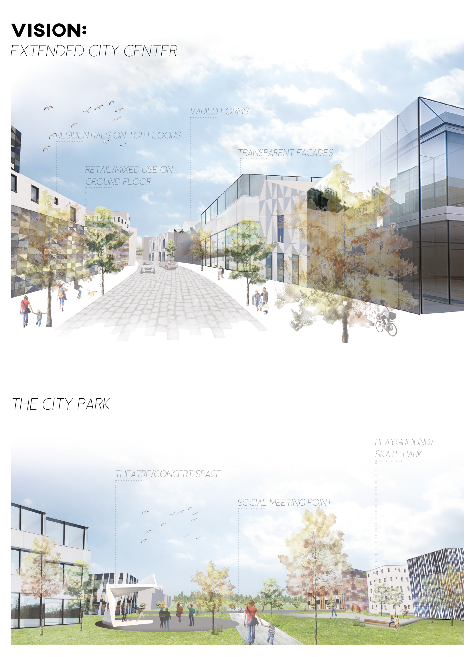
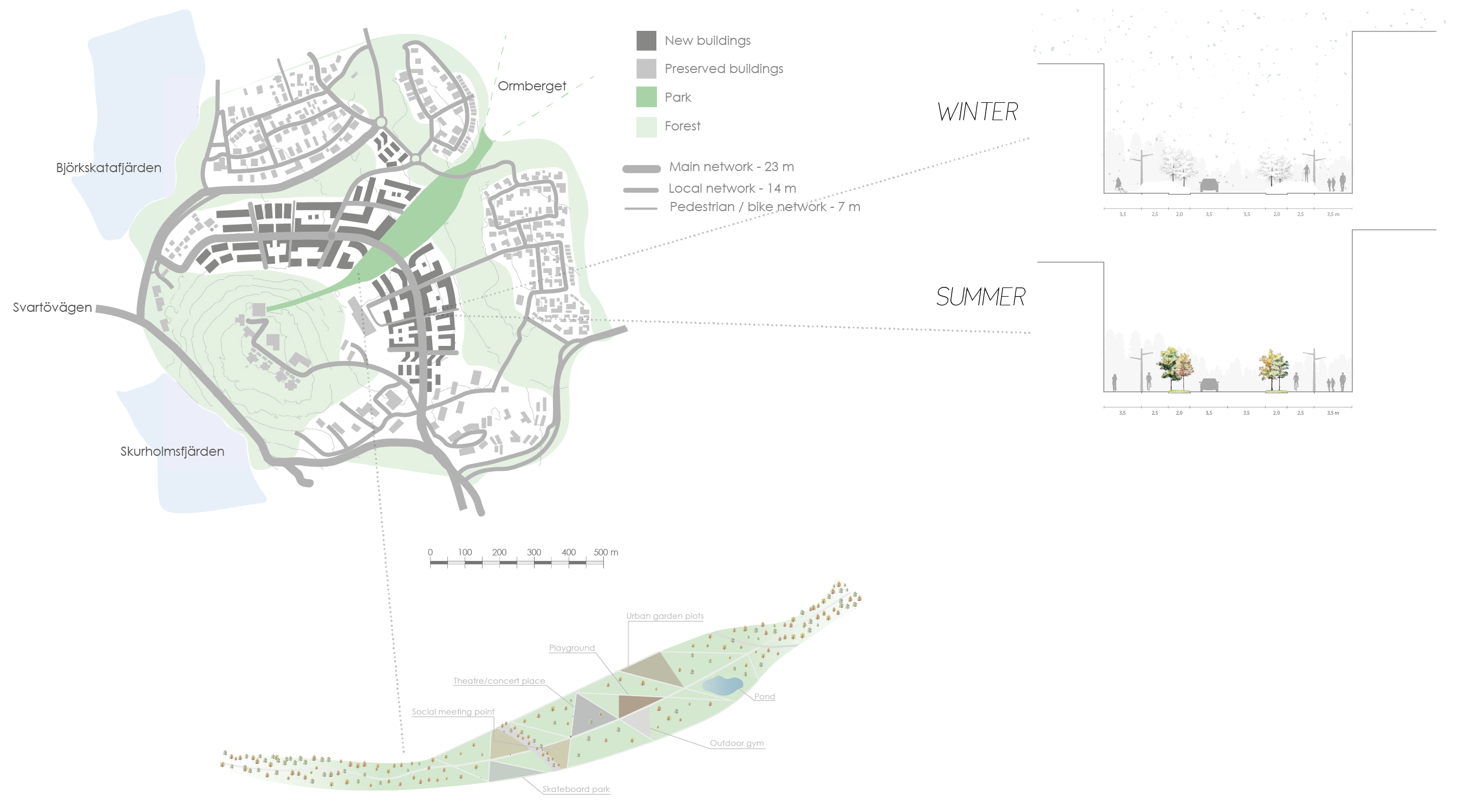 The city park
The intention is to create a dense city centre with easy access to green spaces. This intention resulted in a park in between the highest density city blocks. The park and the dense centre will encourage a pattern of human activity along our movement pattern which was presented in the strategy. The park connects the area to the important surrounding areas; Ormberget and Lulsundsberget. The local bus stop is situated in the intersection of the park and the extended city center. During summer there will be many different social activities in the park, from an outdoor gym to an outdoor concert plot and a skating park. During the winter there will be an iceskating circuit on the pond and a skiing path connection between Ormberget and Lulsundsberget through the park. The high amount of different activities in the park will contribute to a social and lively district center.